

Mastering How to Read Windy App for Precision Weather Forecasts and Thrilling Outdoor Escapes
- Get Out and Kayak

- Feb 3
- 6 min read
For Sea Lovers of All Kinds...Not Just Kayakers!
At Get Out and Kayak, we live by one simple idea: a good day at sea starts well before you even think about touching the water!
You don’t need to be a kayaker, sailor, or hardcore water person to understand the sea. You just need the right tools and a basic idea of what they’re telling you. One of our favorite and most dependable tools is the Windy app.
It’s used by everyone from professional sailors to casual beach lovers. Once you understand the basics, it becomes incredibly useful. Let’s walk through it together!
How to Read the Windy App
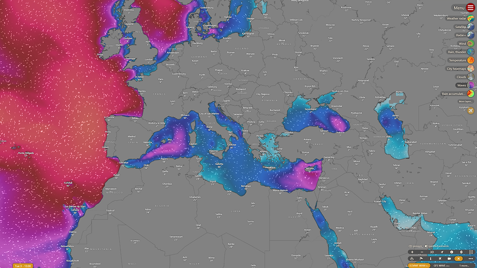
When you first open Windy, you’ll see a colorful moving map with animated lines flowing across it. This looks dramatic, but don’t worry! You’re not expected to understand everything instantly.

Those moving lines show wind direction, while the colors indicate wind strength. Light colors usually mean lighter winds, and stronger colors indicate stronger winds. Already, you can start spotting calmer and rougher areas around the island!

Now comes the important part: zoom in! Windy becomes more accurate the more you zoom into the exact place you’re interested in. A general island view is helpful, but sea conditions can change dramatically from one bay to another.
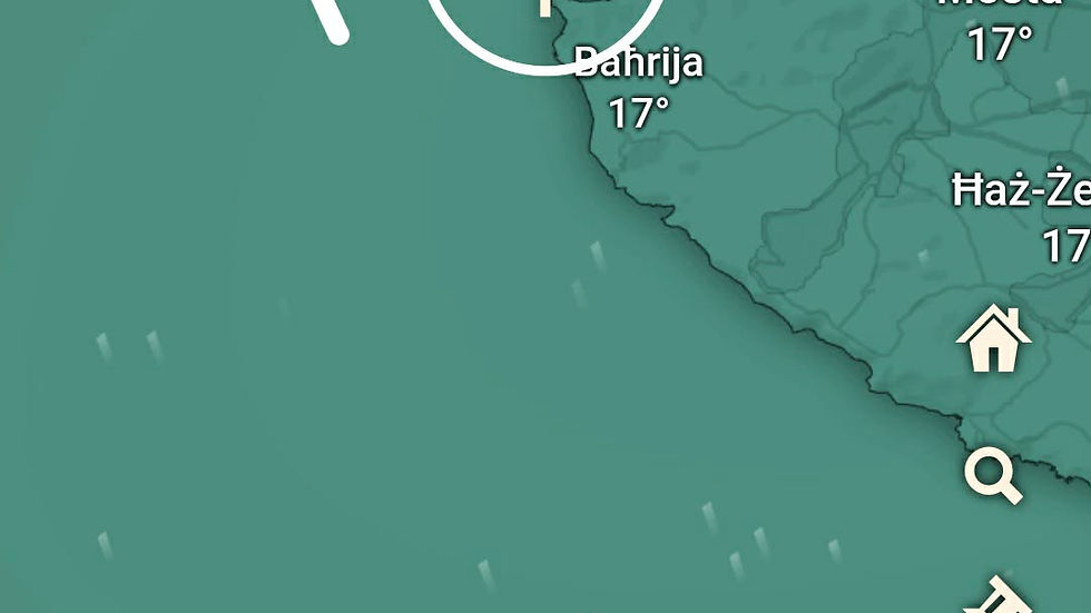
Zoom in on the exact beach, bay, or stretch of coast you want to visit. For this exercise, we’re choosing Gnejna on the west coast. Note that the pin location is OUTSIDE the bay where we plan to paddle, not the beach itself. Click the "Waves and Tides" filter (see below pic).

This opens a detailed forecast panel. If you’re using the mobile version, take a look, as your experience may slightly differ. You’ll have to click a button that says, "Forecast for this point," as shown below.
Here, you’ll see wind speed, wind direction, gusts, cloud cover, rain, air pressure, and very importantly, wave and swell information. This is where many people make a mistake: they look only at wind. Let’s take a closer look.

One of the most important lessons we share with our community is that calm winds do not always mean a calm sea. Swell and underwater currents can be deceptive, even when the air feels still.
However, looking at the current forecast, the wind itself is the primary concern. We’re seeing steady Force 4 winds with gusts hitting Force 5 and 6. Midweek looks even more treacherous, with Wednesday predicted to reach gusts of Force 8.
Knowing Your Limits
To help you plan your own adventures, here’s how we at Get Out and Kayak Malta gauge the conditions:
For Beginners: We recommend sticking to Force 3 winds or less. This ensures a manageable, enjoyable paddle where you can focus on technique rather than fighting the elements.
For Experienced Paddlers: If you have a solid paddle plan and the right gear and skills, only you can determine what you can safely handle.
Waves can travel very long distances and arrive even on days that look peaceful. Windy makes this easy to see if you know where to look, so pay attention to wave height and wave direction.
Wave height tells you how big the waves are. Direction tells you where they’re coming from.

If waves are moving directly toward an open coast, expect rougher water and breaking waves. If waves are moving from land toward the sea inside a bay or harbor, conditions are usually calmer and more relaxed. From reading the above chart, is it safe for kayaking? NO!
Understanding Wave Height and Swell
Just like wind, wave height plays a massive role in whether a paddle will be a dream or a struggle. Many people look at the wind and forget that waves can travel from hundreds of kilometers away, arriving as a heavy "swell" even on a day with no breeze.

At Get Out and Kayak Malta (GOAK), we keep our wave height limits simple and safe:
For Beginners: We recommend a wave height of 0.4m or less. This keeps the water manageable and ensures you can focus on your stroke and the scenery without worrying about stability.
For Advanced Kayakers: As with the wind, you must set your own limits based on your skills and always have a solid paddle plan in place.
The GOAK Standard: Generally, we don’t go out with the community in swells of 0.5m or more. We’ll be the first to admit it: we are generally fair-weather kayakers! We prefer the "lake-like" conditions that make Il-Qarraba Bay's water look like glass.
💡 Pro Tip: Check the Whole Route
Don’t just look at the forecast for your launch point. Sea conditions can change dramatically as you move along the coast. Always check various points along your intended route for both the journey out and the return leg. A bay that is sheltered at 10:00 AM might be catching a heavy side-on swell by noon!
This is why sheltered areas often feel pleasant even when other parts of the coast look wild. Windy helps you spot this difference instantly.
Another helpful detail is the swell period. Longer periods usually mean slower, more powerful waves. Shorter periods usually mean choppier water. Even small waves can feel uncomfortable if they’re close together.
Air pressure is also worth a quick glance. Rising pressure often means improving weather. Falling pressure can signal unstable conditions. You don’t need to be a meteorologist to notice patterns over time. Using different filters on Windy gives you different information, including air pressure, precipitation, etc.

So how should a beginner use Windy?
Pick the exact spot or route you want to visit or paddle.
Check wind strength and direction.
Check wave height and direction.
Ask yourself one simple question: Is this area exposed or sheltered today?
Do my abilities allow me, and the most inexperienced paddler, to go out today?
If it looks uncomfortable, choose a different location or a different day, or stay in the bay and explore the coast. That’s not canceling plans; that’s making smart plans! Kayak safely today so you can go back out tomorrow.
Living on a small island gives us options. When one side is rough, another side is often calm. Windy helps you find it.
This applies whether you’re kayaking, swimming, paddleboarding, snorkeling, or just planning a beach day. The sea doesn’t care how confident you feel. Planning always wins!
Use it often! Compare what you see on the app with what you see in real life. Over time, things start to click. We also use many other apps and websites to make our decisions. If you’d like to check this blog to learn more about Windfinder!
And suddenly, you’re no longer guessing. You’re choosing.
Curious how others plan their sea days?
Find us on Facebook at Get Out and Kayak Malta and join the conversation. You’re welcome to also join our fb group.
Thinking about kayaking but don’t own gear? No kayak, no problem! We have you covered! We invite you to join our WhatsApp Kayak Hotline, where we share kayak events first. This is NOT a chat; it’s a notification and message board. 🚣♂️🌞
Thanks for reading! If you have any questions, please leave a comment, and we’ll get back to you ASAP.
Feel free to share!
Check out our 5-star Google Reviews to see what our guests have to say about our tours!
We look forward to seeing you all on the water!
Best regards,
The GOAK Team
🌐 Socials & Contact Info:
Facebook Page: Get Out and Kayak Malta
Facebook Group: Get Out and Kayak Malta Community
Google Reviews (5-Star): https://maps.app.goo.gl/RY9FuM2RhgSQDULa7
WhatsApp Kayak Hotline: +356 7720 0202
Email: info@getoutandkayakmalta.com

Comments